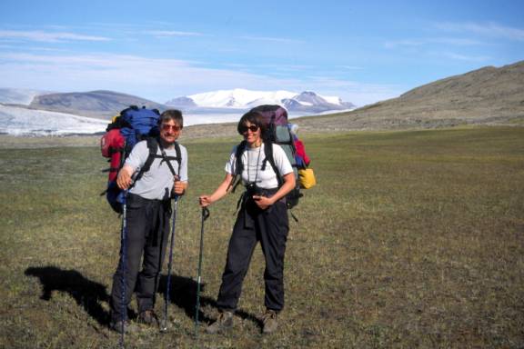
Expecting the Unexpected
The weather was certainly changeable and with little warning. Dark billowing clouds, gusting winds, change of wind direction, a sudden drop in temperature were big hints that something is coming. Monitoring the weather became second nature – you don’t obsess about it but just have the radar out, scanning. In the relative flat of Canada’s mainland arctic barrens, this is pretty straight forward as no large mountains block the horizon or funnel weather down narrow valleys. Here, it was mountain weather. I learned to expect the unexpected which was fun once I relaxed, kept the rain gear on the top of the pack, not brooding about getting wet (or snowed on).
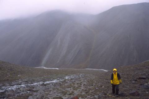
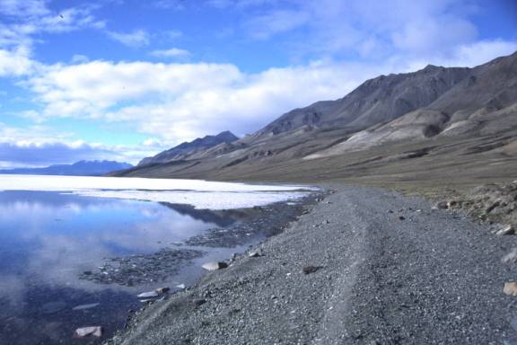
Not only was the weather changeable in the blink of an eye, the degree of fluctuation was staggering. The morning could be below freezing and six hours later, a 20C difference. Lake Hazen on a hot still cloud less few hours…great conditions for our first day on our 14 day trek to Tanquary Fiord.
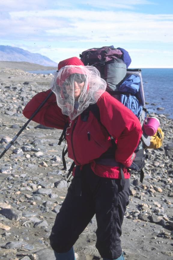
Bugs? What bugs?
I was hoping the stories of mosquitos here would be exaggerated and I’m sad to say, they were not. The little buggers were just as prolific here the typical barren land river (excluding the Thelon which has to be the worst!) or Canadian Shield woods in June. Not sure if they would peter out later in the season (ie September, maybe frozen by then?) but at least they didn’t seem to get any worse during the three weeks we were there. Bonus: no blackflies. With an eye to keeping weight to a minimum, instead of complete bug jackets, a home made head net of bridal veil worked just as well.
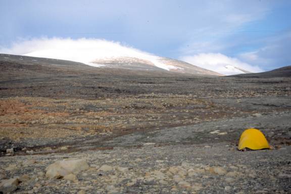
Batten down the hatches….
This picture was taken at 3am. Note the spin drift wind blasting snow from the Ad Astra glacier top. Without warning, a loud thump hit the side of the tent wall: I woke up, wondering what the heck…within seconds, the zipper pulls started a mad dance, jangling against the metal teeth, bashed this way and that by the howling gale. Each and every night, no matter how tired, we made sure the tent was secured down at all points. Tent pegs were sometime ineffective as the soil was too soft and gave no purchase, large rocks became the anchors.
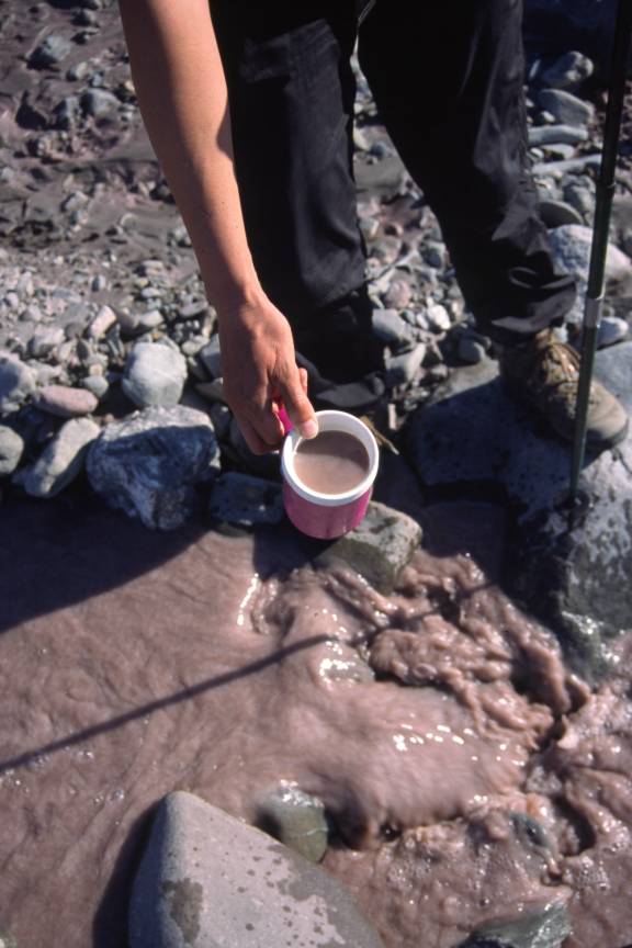
Drink up
I filter water religiously on all southern canoe trips but did not filter water here. The official park mantra advises filtering but after talking with people who had traveled there over the course of many summers (and again, thinking ‘every ounce counts’), we opted to skip bringing the heavy Katadin filter. Silty glacial waters can have an interesting effect on the colonic velocity of some people’s guts! Pepto bismol coffee anyone?
Green Fields
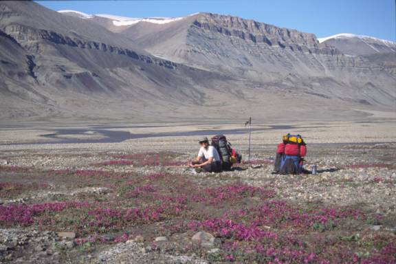
It was an unforgettable last week. The trek to Tanquary Fiord along the Air Force River was amazing with incredible sunny weather, warm temperatures, very few bugs, leisurely walking, left over time (and the energy) for afternoon side trips. My feet danced and our smiles say it all!
Navigation
It’s pretty hard to get lost on a river. When paddling, your route is limited to water and contained between two banks. While hiking, especially above the tree line, especially where there are no paths to follow, no routes marked, no stone cairns, no markers, no sign posts or trail of cookie crumbs to follow, the choices are endless and it’s a whole new navigation world.
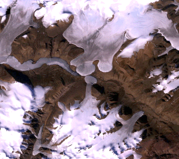
(google sat photo circa 2008 of same image as below)
In 1998, GPS was not available to the consumer market (at least on our budget). This trip would be route finding using maps and hopefully, well developed map reading skills. A compass was unreliable (before departing, I read: “….daily fluctuations in magnetic declination become increasingly large as one approaches the North Magnetic Pole…” from Geological Survey of Canada). Hmmmm and we were going to be well north of the Magnetic pole. I figured just to skip the compass, as it would be pretty much useless (wrong!).
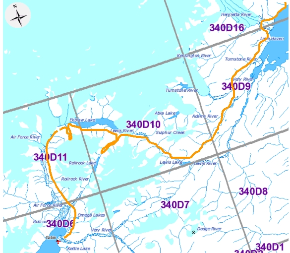
The quality of printed maps varied widely. Some 1:50,000 topos were called ‘photomaps’ (Tanquary Fiord 340 D/6), others were in black and white (Fiala Glacier 340 D/11) while a few (Ekblaw Lake 340 D/10) were mapped to the same quality as southern Canada.
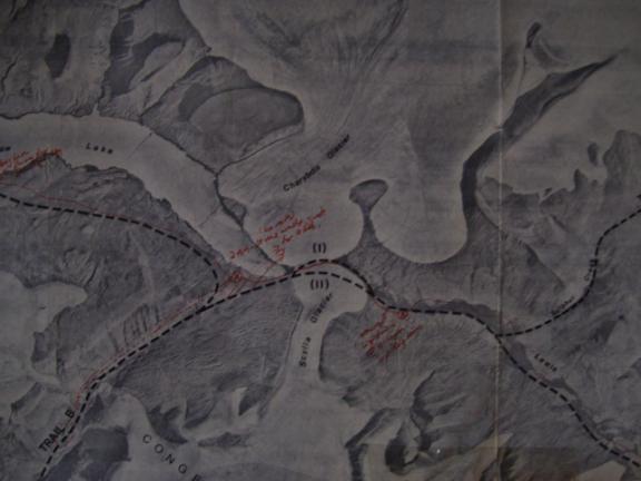
Covering all the bases, we purchased from Parks Canada, the two ‘uncontrolled air photo mosaics’ (‘east half’ and ‘west half’), with a scale of 1:64,000 (miles). In black and white, these maps looked some kindergarten cut and paste project - yikes! However, these mosaics had ‘suggested routes’ (a thick fat black dotted line) marked as well as the survival caches (we didn’t find any but didn’t look very hard either). Just for interest, we also brought along 1:250,000 maps (somewhat cut down – reducing weight/space again) which were useful when looking at distant peaks. Thus completed our paper navigation system.